


The Digital Imaging and Remote Sensing Laboratory coordinated a two-week data collection project with researchers from around the world
Carlos Ortiz/RIT
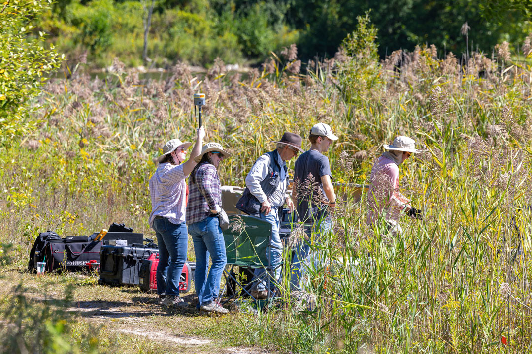
RIT students and researchers work to set up ground-based data collection instruments in the wetlands area of Tait Preserve as part of ROCX 2025.
Satellites, planes, drones, canoes, and more were deployed at RIT’s Tait Preserve for ROCX 2025, an open-community, major data-collection experiment.
Building off similar experiments done in 2010 and 2012, RIT’s Digital Imaging and Remote Sensing (DIRS) Laboratory gathered together more than 60 researchers and students from organizations around the globe to collaborate on-site with RIT students, faculty, and staff. Approximately 20 ground and 20 remote sensing experiments were conducted over the two-week period in September.
“The goal is to provide data that are useful for educational and research purposes to the global community,” said John Kerekes, research professor in the Chester F. Carlson Center for Imaging Science and principal investigator of the project. “We have a history of putting data sets out on our websites and other websites that scientific researchers can use as part of education and training, as well as to research new methodologies to analyze the remote sensing data.”
The DIRS staff had received interest from alumni and the community to do another large data collection project like had been done in 2012 and began to work on the planning of ROCX 2025 in the spring of 2024. The team coordinated surveys and working groups to approve and schedule proposals for the collection. The IEEE Geoscience and Remote Sensing Society signed on as a platinum sponsor for the event while Matter Intelligence and Spectra Vista Corporation were bronze sponsors.
While the collection is complete, the work will continue. By the summer of 2026, all data will be processed and made public for instructional or research purposes. The data collected will be used for decades. The DIRS staff will disseminate results through special sessions at major conferences and peer-reviewed journal special issues over the coming months and years.
The combination of remote sensing data from satellites, aircraft, and drones, combined with ground object deployments and ground truth collection makes the data collection unique, and therefore very useful.
“There’s lots of data out there observing our Earth, but it’s not always coordinated with understanding what’s on the ground,” said Kerekes. “If you want to teach someone how to extract the information from the data, you need that truth.”
Along with Kerekes, Nina Raqueno, research scientist, and Joseph Sirianni, associate director of the DIRS Laboratory, were the co-investigators for the project.
More information on ROCX 2025 and the DIRS Lab is available at the ROCX 2025 website.